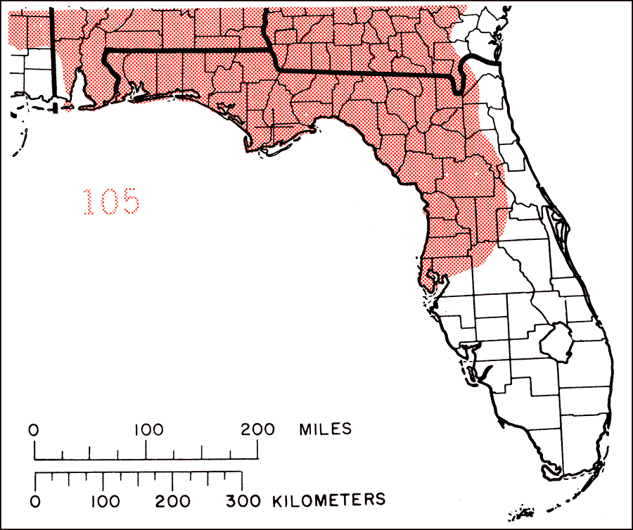
Description: This is a map showing the distribution of the Prunus angustifolia or Chickasaw plum in Florida. "Missouri w. to Kansas, s. Nebraska, and extreme se. Colorado, s. to extreme e. N. Mexico, Texas, and Louisiana. Also naturalized e. to c. Florida and n. to N.J., W. Va., s. Ohio, and Illinois. Extremely naturalized and perhaps spread by Indians in prehistoric times. The original native range thus is not accurately known but probably was c. Texas and Oklahoma according to Sargent (1926, p. 570)." —Elbert L. Little, Jr. For more information, read the introduction to the Atlas of United States Trees Vol. 5 Florida.
Place Names: Temperate Hardwoods P-R, natural distribution of native tree species
ISO Topic Categories: biota, boundaries, environment
Keywords: Prunus angustifolia or Chickasaw plum, physical, political, forestry, trees, county borders, biota, boundaries, environment, Unknown,1978
Source: Elbert L. Little, Jr., Atlas of United States Trees Volume 5 Florida (Washington, D.C.: United States Government Printing Office, 1978)
Map Credit: United States Government Printing Office |
|