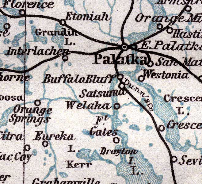
Description: This detail of Putnam County is taken from a handbook for travelers by Karl Baedeker current to 1904. Though made in Leipzig, Germany, the detail was based upon government topographic surveys. It shows footpaths, railways, and roads wherever possible. Special points of interest include Palatka, San Mateo, and Etoniah.
Place Names: Putnam, Etoniah, Palatka, Buffalo Bluff, Satsuma, Fort Gates, Eureka, Orange Springs, Interlachen, San Mateo, Westonia,
ISO Topic Categories: transportation, inlandWaters, location, oceans
Keywords: Putnam County, political, transportation, county borders, railroads, roads, transportation, inlandWaters, location, oceans, Unknown,1904
Source: Karl Baedeker, The United States with an Excursion into Mexico (Leipzig, Germany: Wagner & Debes Geog., 1904)
Map Credit: Courtesy of the private collection of Roy Winkelman. |
|