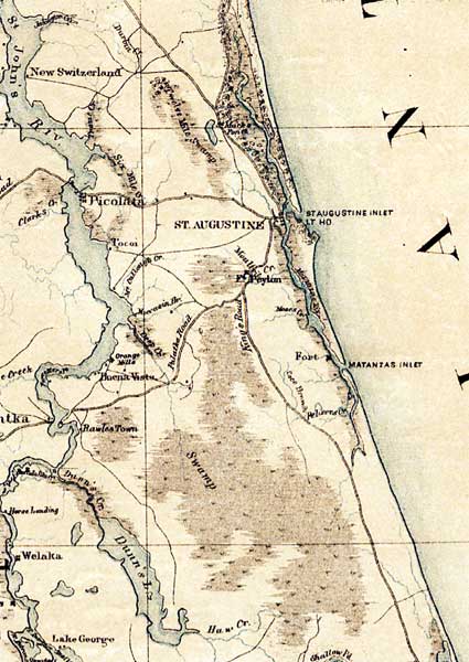
Description: This detail of map of northern peninsular Florida from the U.S. Coast Survey Office shows major rivers, towns, roads, and railroads in Saint Johns County. The detail features swamp land as well as naming where there is level pine land. The Saint Johns River is shown, in addition to numerous lakes. The largest town in the detail is Saint Augustine.
Place Names: St. Johns, Saint Augustine, Matanzas, Picolata, Dunn's Lake, Tocoi, New Switzerland,
ISO Topic Categories: boundaries, inlandWaters, oceans, society, transportation
Keywords: St. Johns County, physical, political, transportation, historical, physical features, major political subdivisions, roads, railroads, Civil War, boundaries, inlandWaters, oceans, society, transportation, Unknown,1864
Source: H. Lindenkohl, (Washington, DC: United States Coast Survey Office, 1864)
Map Credit: Courtesy of the National Archives and Records Administration |
|