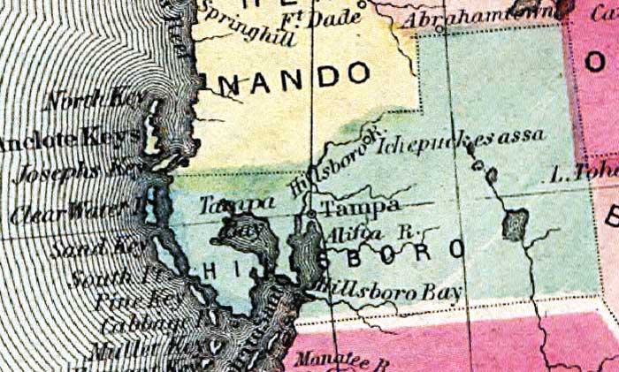
Description: This detail of Hillsborough County is current to 1860. This map shows drainage, state and county boundaries, place names, steamboat routes, and the railroad network. Each county is colored pastel for ease of differentiation. The main feature of this detail is Tampa.
Place Names: Hillsborough, Hillsboro River, Tampa, Tampa Bay, Hillsboro Bay, North Key, Anclote Key, Josephs Key, Manatee River, Sand Key,
ISO Topic Categories: transportation, inlandWaters, location, oceans
Keywords: Hillsborough County, political, county borders, transportation, inlandWaters, location, oceans, Unknown,1860
Source: , (, : , 1860)
Map Credit: Courtesy of the private collection of Roy Winkelman. |
|