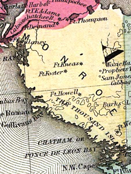
Description: This detail of the mainland of Manatee County is current to 1860. This map shows drainage, state and county boundaries, place names, steamboat routes, and the railroad network. Each county is colored pastel for ease of differentiation. The main feature of this detail is Ten Thousand Islands.
Place Names: Monroe, Ten Thousand Islands, Dulaney, Fort Foster, Sam Jones, Cape Roman, Cape Romano, Ponce De Leon Bay, Chatham Bay,
ISO Topic Categories: transportation, inlandWaters, location, oceans
Keywords: Monroe County - Mainland, political, county borders, transportation, inlandWaters, location, oceans, Unknown,1860
Source: , (, : , 1860)
Map Credit: Courtesy of the private collection of Roy Winkelman. |
|