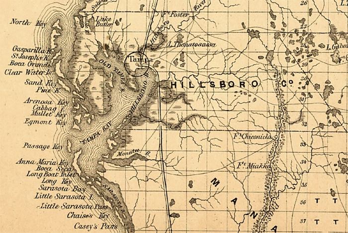
Description: This detail is of a railroad map of Florida showing Hillsborough County's drainage, cities and towns, roads, railroads, location of the land grant railroads and indicating the 6- and 15-mile limits of grants in 1859. Township grids based on the Tallahassee basis parallel and the Tallahassee prime meridian shows the extent of land survey in Florida. Land office locations are given.
Place Names: Hillsborough, Tampa, Thonotosassa, Old Tampa Bay, Tampa Bay, Hillsboro Bay, Gasparilla Key, Boca Grande, Pine Key, Manatee River,
ISO Topic Categories: transportation, inlandWaters, boundaries
Keywords: Hillsborough County, physical, political, transportation, physical features, county borders, railroads, roads, transportation, inlandWaters, boundaries, Unknown,1859
Source: , Annual Report of the Surveyor General (New York, NY: General Land Office, 1859)
Map Credit: Courtesy of the Geography and Map Division of the Library of Congress |
|