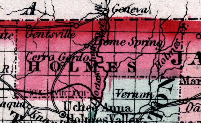
Description: Map of Holmes county, current to 1860, shows county lines, lakes, numerous forts. Gentsville, Homes Spring, and Cerro Gordo are among the features of this map.
Place Names: Holmes, Gentsville, Cerro Gordo, Home Spring, Holmes Creek,
ISO Topic Categories: boundaries, inlandWaters, transportation
Keywords: Holmes County, physical, political, historical, transportation, physical features, county borders, roads, boundaries, inlandWaters, transportation, Unknown,1860
Source: Johnson, A.J., Johnson's New Illustrated Family Atlas (New York, NY: Johnson and Browning , 1860) 40
Map Credit: Courtesy the private collection of Roy Winkelman. |
|