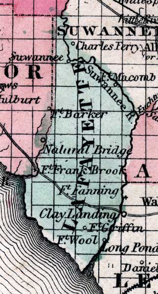
Description: Map of Lafayette county, current to 1860, shows county lines, lakes, numerous forts. The central water feature of this detail is the Suwannee River. Other features include Fort Fanning, Clay Landing, and Fort Barker.
Place Names: Lafayette, Fort Fanning, Fort Barker, Clay LAnding, Fort Wool, Fort Griffin, Fort Frank Brook, Suwannee River,
ISO Topic Categories: boundaries, inlandWaters, transportation
Keywords: Lafayette County, physical, political, historical, transportation, physical features, county borders, roads, boundaries, inlandWaters, transportation, Unknown,1860
Source: Johnson, A.J., Johnson's New Illustrated Family Atlas (New York, NY: Johnson and Browning , 1860) 40
Map Credit: Courtesy the private collection of Roy Winkelman. |
|