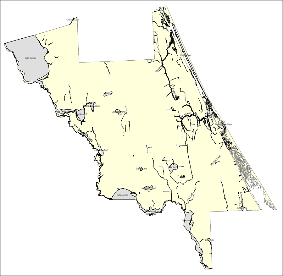
Description: This map was created by FCIT and shows the waterways of Volusia County. All major rivers, streams, creeks, lakes, and swamps are labeled. This map features Bulow Creek, Halifax River, Priest Branch, Tomoka River, Spruce Creek, Indian River North, Crescent Lake, Lake George, Lake Dexter, Lake Woodruff, Spring Garden Lake, Lake Diaz, Lake Daugharty,St. Johns River, Little Cow Creek, Lake Ashby, Dupont Lake, Lake Butler Chain, Lake Monroe, Lake Beresford, Lake Jesup, Lake Harney, Buck Lake, and Cow Creek.
Place Names: Volusia, Bulow Creek, Halifax River, Priest Branch, Tomoka River, Spruce Creek, Indian River North, Crescent Lake, Lake George, Lake Dexter, Lake Woodruff, Spring Garden Lake, Lake Diaz, Lake Daugharty,St. Johns River, Little Cow Creek, Lake Ashby, Dupont Lake, Lake Butler Chain, Lake Monroe, Lake Beresford, Lake Jesup, Lake Harney, Buck Lake, Cow Creek
ISO Topic Categories: boundaries, inlandWaters
Keywords: Florida Waterways: Volusia County Outline, political, physical, kriversandstreams, physical features, county borders, photograph in shape of map, photo, Florida mapboundaries, inlandWaters, 2008
Source: Florida Center for Instructional Technology, (Tampa, FL: University of South Florida, 2008)
Map Credit: Courtesy of the Florida Center for Instructional Technology |
|