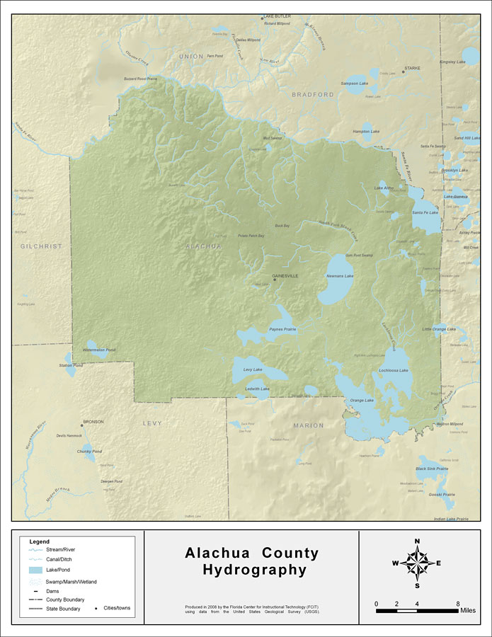
Description: This map was created by FCIT and shows the waterways of Alachua County. All major rivers, streams, creeks, lakes, and swamps are labeled. This map details the Santa Fe River, Watermelon Pond, Little Monteocha Creek, Lake Altro, South Fork Black Creek, Newnans Lake, Santa Fe Lake, Little Orange Lake, Lochloosa Creek, Lochloosa Lake, Orange Lake, Orange Creek, Ledwith Lake, Levy Lake, and Payness Prairie.
Place Names: Alachua, Santa Fe River, Watermelon Pond, Little Monteocha Creek, Lake Altro, Lake Altho, South Fork Black Creek, Newnans Lake, Santa Fe Lake, Little Orange Lake, Lochloosa Creek, Lochloosa Lake, Orange Lake, Orange Creek, Ledwith Lake, Levy Lake, Payness Prairie, Paynes Prairie, Buck Bay, Potato Patch Bay, Gainsville
ISO Topic Categories: boundaries, inlandWaters
Keywords: Florida Waterways: Alachua County , political, physical, kriversandstreams, physical features, county borders, photograph in shape of map, photo, Florida mapboundaries, inlandWaters, 2008
Source: Florida Center for Instructional Technology, (Tampa, FL: University of South Florida, 2008)
Map Credit: Courtesy of the Florida Center for Instructional Technology |
|