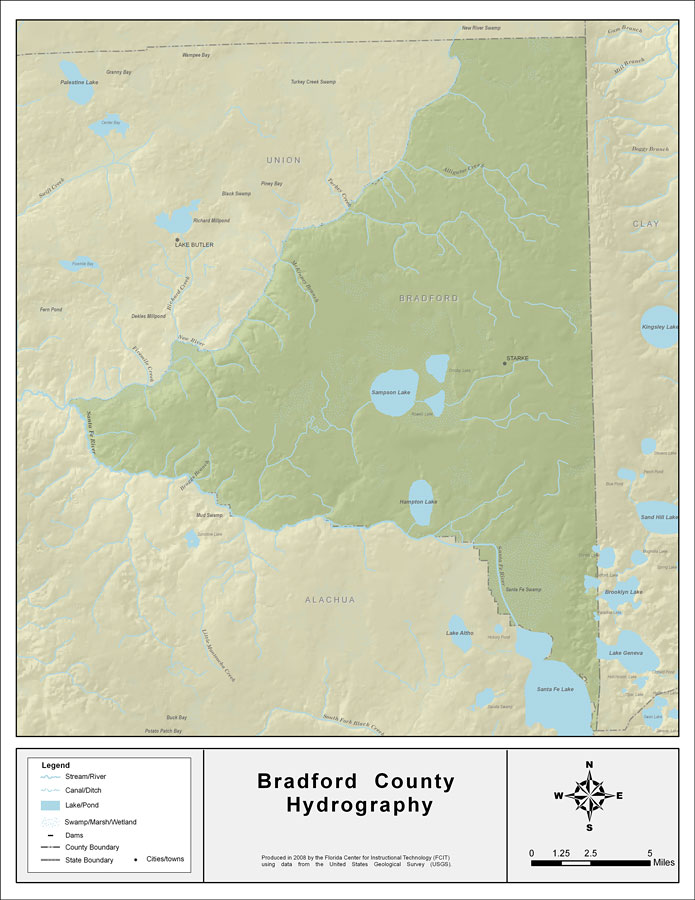
Description: This map was created by FCIT and shows the waterways of Bradford County. All major rivers, streams, creeks, lakes, and swamps are labeled. This map features New River, Alligator Creek, Gum Creek, Sampson Lake, Hampton Lake, Santa Fe River, Santa Fe Lake, Lake Geneva, Braggs Branch, and McKinney Branch.
Place Names: Bradford, New River, Alligator Creek, Gum Creek, Sampson Lake,Hampton Lake, Santa Fe River, Santa Fe Lake, Lake Geneva, Braggs Branch, McKinney Branch, Starke
ISO Topic Categories: boundaries, inlandWaters
Keywords: Florida Waterways: Bradford County , political, physical, kriversandstreams, physical features, county borders, photograph in shape of map, photo, Florida mapboundaries, inlandWaters, 2008
Source: Florida Center for Instructional Technology, (Tampa, FL: University of South Florida, 2008)
Map Credit: Courtesy of the Florida Center for Instructional Technology |
|