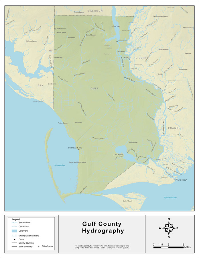
Description: This map was created by FCIT and shows the waterways of Gulf County. All major rivers, streams, creeks, lakes, and swamps are labeled. This map features Stone Mill Creek, Big Branch, Dead Lake, Guardhouse Branch, Sandy Branch, Little Sandy Creek, Wetappo Creek, Little Creek, Willburn Branch, Virginia Cut, Chipola River, the Apalachicola River, Joe Lamb Branch, Gude Branch, Intracoastal Waterway, Cypress Creek, Howard Creek, the Brothers River, Horseshoe Creek, the Jackson River, Lake Wimico, Little Double Creek, Clark Creek, Saul Creek, Catfish Slough, and Depot Creek.
Place Names: Gulf, Stone Mill Creek, Big Branch, Dead Lake, Guardhouse Branch, Sandy Branch, Little Sandy Creek, Wetappo Creek, Little Creek, Willburn Branch, Virginia Cut, Chipola River, Appalachicola River, Joe Lamb Branch, Gude Branch, Intracoastal Waterway, Cypress Creek, Howard Creek, Brothers River, Jackson River, Horseshoe Creek, Jackson River, Lake Wimico, Little Double Creek, Clark Creek, Saul Creek, Catfish Slough, Depot Creek, Port St. Joe
ISO Topic Categories: boundaries, inlandWaters
Keywords: Florida Waterways: Gulf County , political, physical, kriversandstreams, physical features, county borders, photograph in shape of map, photo, Florida mapboundaries, inlandWaters, 2008
Source: Florida Center for Instructional Technology, (Tampa, FL: University of South Florida, 2008)
Map Credit: Courtesy of the Florida Center for Instructional Technology |
|