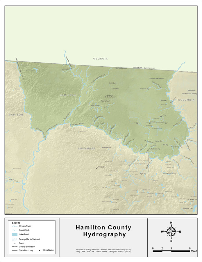
Description: This map was created by FCIT and shows the waterways of Hamilton County. All major rivers, streams, creeks, lakes, and swamps are labeled. This map features the Withlacoochee River, the Withlacoochee River (North), Alapaha River, Turket Creek, Alligator Creek, Alittle Alapaha River, Mitchell Creek, Mill Creek, Ratliff Creek, Sugar Creek, Camp Branch, Jerry Branch, McCall Branch, Swift Creek, Sal Marie Branch, Four Mile Branch, and Roaring Creek.
Place Names: Hamilton, Withlacoochee River, Withlacoochee River (North), Alapaha River, Turket Creek, Alligator Creek, Alittle Alapaha River, Mitchell Creek, Mill Creek, Ratliff Creek, Sugar Creek, Camp Branch, Jerry Branch, McCall Branch, Swift Creek, Sal Marie Branch, Four Mile Branch, Roaring Creek, Jasper
ISO Topic Categories: boundaries, inlandWaters
Keywords: Florida Waterways: Hamilton County , political, physical, kriversandstreams, physical features, county borders, photograph in shape of map, photo, Florida mapboundaries, inlandWaters, 2008
Source: Florida Center for Instructional Technology, (Tampa, FL: University of South Florida, 2008)
Map Credit: Courtesy of the Florida Center for Instructional Technology |
|