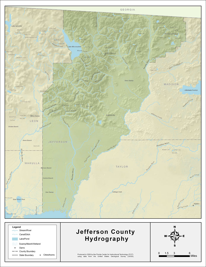
Description: This map was created by FCIT and shows the waterways of Jefferson County. All major rivers, streams, creeks, lakes, and swamps are labeled. This map features Wards Creek, Lake Miccosukee, Caney Creek, Drifton Branch, Mill Pond Creek, Morris Branch, Cuba Branch, Caney Branch, Wacissa River, Moore Branch, Sweetwater Branch, Saint Marks River, Aucilla River, Wolf Creek, Jones Mill Creek, Cow Creek, and Oyster Creek.
Place Names: Jefferson, Wards Creek, Lake Miccosukee, Caney Creek, Drifton Branch, Mill Pond Creek, Morris Branch, Cuba Branch, Caney Branch, Wacissa River, Moore Branch, Sweetwater Branch, Saint Marks River, Aucilla River, Wolf Creek, Jones Mill Creek, Cow Creek, Oyster Creek, Monticello
ISO Topic Categories: boundaries, inlandWaters
Keywords: Florida Waterways: Jefferson County , political, physical, kriversandstreams, physical features, county borders, photograph in shape of map, photo, Florida mapboundaries, inlandWaters, 2008
Source: Florida Center for Instructional Technology, (Tampa, FL: University of South Florida, 2008)
Map Credit: Courtesy of the Florida Center for Instructional Technology |
|