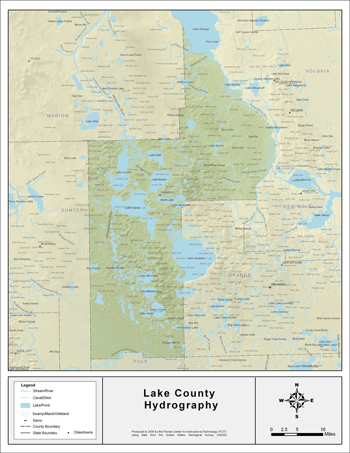
Description: This map was created by FCIT and shows the waterways of Lake County. All major rivers, streams, creeks, lakes, and swamps are labeled. This map features Juniper Creek, Lake George, Jumping Gully, Sellers Lake, Ninemile Creek, Lake Dexter, Get Out Creek, St. Johns River, Black Water Creek, Lake Norris, Sulphur Run, Ella Lake, Lake Yale, Haines Creek, Wekiva River, Seminole Creek, Lake Eustis, Lake Giffin, Oklawaha River, Lake Harris, Lake Apopka, Palatlakaha River, Big Prairie, Big Bluff Lake, Lake Minneola, Lake Minnehaha, Johns Lake, Lake Louisa, Lake Nellie, and Boggy Marsh.
Place Names: Lake, Juniper Creek, Lake George, Jumping Gully, Sellers Lake, Ninemile Creek, Lake Dexter, Get Out Creek, St. Johns River, Black Water Creek, Lake Norris, Sulphur Run, Ella Lake, Lake Yale, Haines Creek, Wekiva River, Seminole Creek, Lake Eustis, Lake Giffin, Oklawaha River, Lake Harris, Lake Apopka, Palatlakaha River, Big Prairie, Big Bluff Lake, Lake Minneola, Lake Minnehaha, Johns Lake, Lake Louisa, Lake Nellie, Boggy Marsh, Tavares
ISO Topic Categories: boundaries, inlandWaters
Keywords: Florida Waterways: Lake County , political, physical, kriversandstreams, physical features, county borders, photograph in shape of map, photo, Florida mapboundaries, inlandWaters, 2008
Source: Florida Center for Instructional Technology, (Tampa, FL: University of South Florida, 2008)
Map Credit: Courtesy of the Florida Center for Instructional Technology |
|