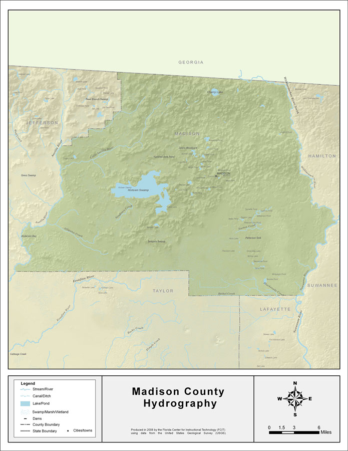
Description: This map was created by FCIT and shows the waterways of Madison County. All major rivers, streams, creeks, lakes, and swamps are labeled. This map features Withlacoochee River North, Suwannee River, North Creek, Hixtown Swamp, Sundown Creek, Alligator Creek, Rocky Creek, Little Aucilla River, Cherry Lake, Aucilla River, Norton Creek, Bethel Creek, Blacksnake Creek, and Springhead Creek.
Place Names: Madison, Withlacoochee River North, Suwannee River, North Creek, Hixtown Swamp, Sundown Creek, Alligator Creek, Rocky Creek, Little Aucilla River, Cherry Lake, Aucilla River, Norton Creek, Bethel Creek, Blacksnake Creek, Springhead Creek, Madison
ISO Topic Categories: boundaries, inlandWaters
Keywords: Florida Waterways: Madison County , political, physical, kriversandstreams, physical features, county borders, photograph in shape of map, photo, Florida mapboundaries, inlandWaters, 2008
Source: Florida Center for Instructional Technology, (Tampa, FL: University of South Florida, 2008)
Map Credit: Courtesy of the Florida Center for Instructional Technology |
|