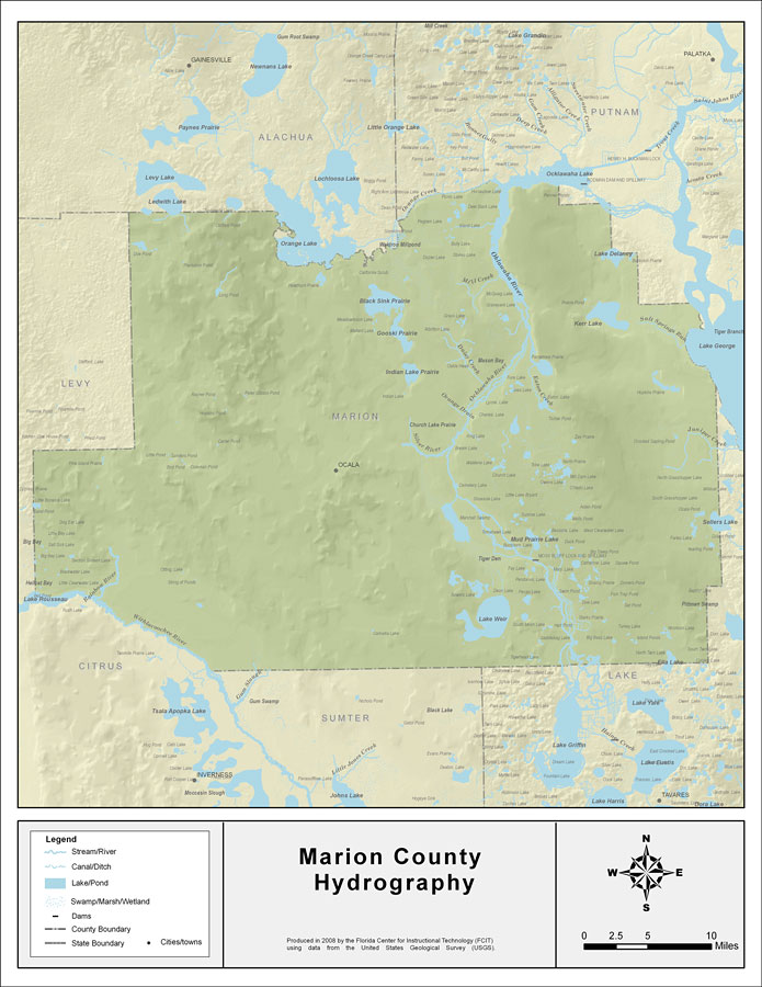
Description: This map was created by FCIT and shows the waterways of Marion County. All major rivers, streams, creeks, lakes, and swamps are labeled. This map features Orange Creek, Black Sink Prairie, Mill Creek, Oklawaha Lake, Ledwith Lake, Silver River, Gooski Prairie, Indian Lake Prairie, Daisy Creek, Ocklawaha River, Orange Drain, Juniper Creek, Eaton Creek, Kerr Lake, Lake Delancy, Lake George, St. Johns River, Mud Prairie Lake, Lake Weir, Ella Lake, and Seller Lake.
Place Names: Marion, Orange Creek, Black Sink Prairie, Mill Creek, Oklawaha Lake, Ledwith Lake, Silver River, Gooski Prairie, Indian Lake Prairie, Daisy Creek, Ocklawaha River, Orange Drain, Juniper Creek, EAton Creek, Kerr Lake, Lake Delancy, Lake George, St. Johns River, Mud Prairie Lake, Lake Weir, Ella Lake, Seller Lake, Ocala
ISO Topic Categories: boundaries, inlandWaters
Keywords: Florida Waterways: Marion County , political, physical, kriversandstreams, physical features, county borders, photograph in shape of map, photo, Florida mapboundaries, inlandWaters, 2008
Source: Florida Center for Instructional Technology, (Tampa, FL: University of South Florida, 2008)
Map Credit: Courtesy of the Florida Center for Instructional Technology |
|