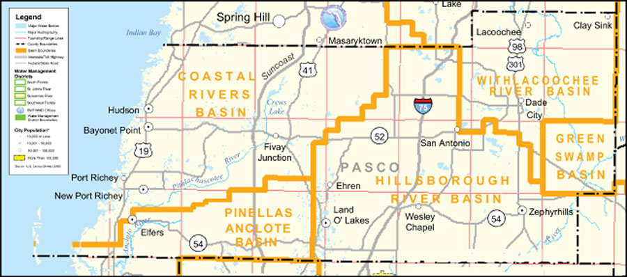
Description: This is a county detail map of Pasco County extracted from the Southwest Florida Watershed Management District or SWFWMD district map, created on September 28, 2004. This map shows major inland water, township/range lines (in pink), county boundaries, basin boundaries (orange), interstate roads, Federal/State roads, SWFWMD offices (shown with logo), and city population.
Place Names: Pasco, Indian Bay, �Hillsborough River Basin, �Withlacoochee River Basin, �Coastal Rivers Basin, �Pinellas Anclote Basin, �Green Swamp Basin, �San Antonio, �Dade City, �Lacoochee, �Zephyrhills , �Wesley Chapel, �Land O' Lakes, �Elfers, �Bayonet Point, �Port Richey, �New Port Richey, �Ehren, �Clay Sink, �Fivay Junction, �Hudson, �Anclote River, �Pithlachascotee River
ISO Topic Categories: boundaries, �inlandWaters, �transportation, �geoscientificInformation
Keywords: Southwest Florida Water Management District- Pasco County, physical, �political, �transportation, �hydrological, �watershed, �kwatershed, physical features, county borders, roads, boundaries, �inlandWaters, �transportation, �geoscientificInformation, Unknown,September 28, 2004
Source: Southwest Florida Water Management District Mapping and GIS Section, Southwest Florida Water Management District Map of Districts (Brooksville, FL: Southwest Florida Water Management District, September 28, 2004)
Map Credit: Courtesy of the Southwest Florida Water Management District |
|
