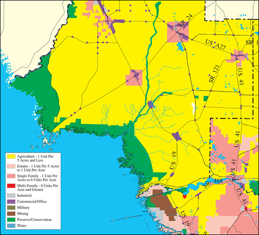
Description: This is a detail map of Levy County extracted from the Southwest Florida Watershed Management District or SWFWMD Withlacoochee River Watershed Distribution of Generalized Future Land Use, ca. 2010 map, created on May 9, 2001. Land use/cover information shown is agriculture (yellow), estates (light pink), single family (pink), multi-family (red), industrial (light gray), commercial/office (purple), military (olive green), mining (brown), preserve/conservation (green) and water (blue). It also shows major roads, inland water, and county boundaries. From the original map: "Future land use data were obtained from the Southwest Florida Regional Planning Council. The data are intended to provide a generalized future view of the region. For specific future land use categories, please contact the local government(s) in this region. The date of these data is circa 2010, as they were obtained from all the local governments, each of which uses a different date." —Southwest Florida Watershed Management District
Place Names: Levy, Levy, �Levy County
ISO Topic Categories: boundaries, �geoscientificInformation, �inlandWaters, �transportation
Keywords: Withlacoochee River Watershed Distribution of Generalized Future Land Use, Ca. 2010- Levy County, physical, �political, �transportation, �hydrological, �watershed, �kwatershed, physical features, county borders, roads, boundaries, �geoscientificInformation, �inlandWaters, �transportation, Unknown,May 9, 2001
Source: Southwest Florida Water Management District, Withlacoochee River Comprehensive Watershed Management Plan Atlas, Withlacoochee River Watershed Distribution of Generalized Future Land Use, Ca. 2010 Map (Brooksville, FL: Southwest Florida Water Management District, 2001)
Map Credit: Courtesy of the Southwest Florida Water Management District |
|