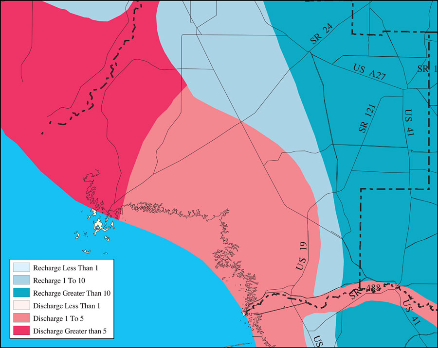
Description: This is a detail map of Levy County extracted from the Southwest Florida Watershed Management District or SWFWMD Withlacoochee River watershed recharge to and discharge from the Floridian aquifer in inches per year map, created on May 9, 2001. The recharge and discharge are shown by color. Recharge is shown in blue from least (light blue) to greatest (dark blue). Discharge is shown from least (off white) to greatest (dark pink). It also shows US/State roads, inland water and county boundaries. "These data were digitized from the map in the USGS document "Areal Variation in Recharge to and Discharge from the Floridian Aquifer System in Florida," Investigations Report 88-4057 by W. R. Aucott. The scale of the source map was approximately 1:1,000,000." —Southwest Florida Watershed Management District
Place Names: Levy, Levy, �Levy County
ISO Topic Categories: boundaries, �geoscientificInformation, �inlandWaters, �transportation
Keywords: Withlacoochee River Watershed Recharge to/Discharge from the Floridan Aquifer In Inches Per Year- Levy County, physical, �political, �transportation, �hydrological, �watershed, �kwatershed, physical features, county borders, roads, boundaries, �geoscientificInformation, �inlandWaters, �transportation, Unknown,May 9, 2001
Source: Southwest Florida Water Management District, Withlacoochee River Comprehensive Watershed Management Plan Atlas, Withlacoochee River Watershed Recharge to/Discharge from the Floridan Aquifer In Inches Per Year Map (Brooksville, FL: Southwest Florida Water Management District, 2001)
Map Credit: Courtesy of the Southwest Florida Water Management District |
|