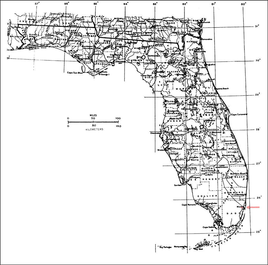
Description: This is a map showing the distribution of the Amphitecna latifolia or black-calabash in Florida. "Very rare in s. Florida (Biscayne Bay incl. Brickell Hammock, Dade Co.). Widespread in tropical Am. in West Indies incl. Puerto Rico and Virgin Islands, and from s. Mexico, s. to Ecuador and Venezuela." —Elbert L. Little, Jr. For more information, read the introduction to the Atlas of United States Trees Vol. 5 Florida.
Place Names: Tropical Hardwoods A-C, natural distribution of native tree species
ISO Topic Categories: biota, boundaries, environment
Keywords: Amphitecna latifolia or black-calabash, physical, political, forestry, trees, county borders, biota, boundaries, environment, Unknown,1978
Source: Elbert L. Little, Jr., Atlas of United States Trees Volume 5 Florida (Washington, D.C.: United States Government Printing Office, 1978)
Map Credit: United States Government Printing Office |
|