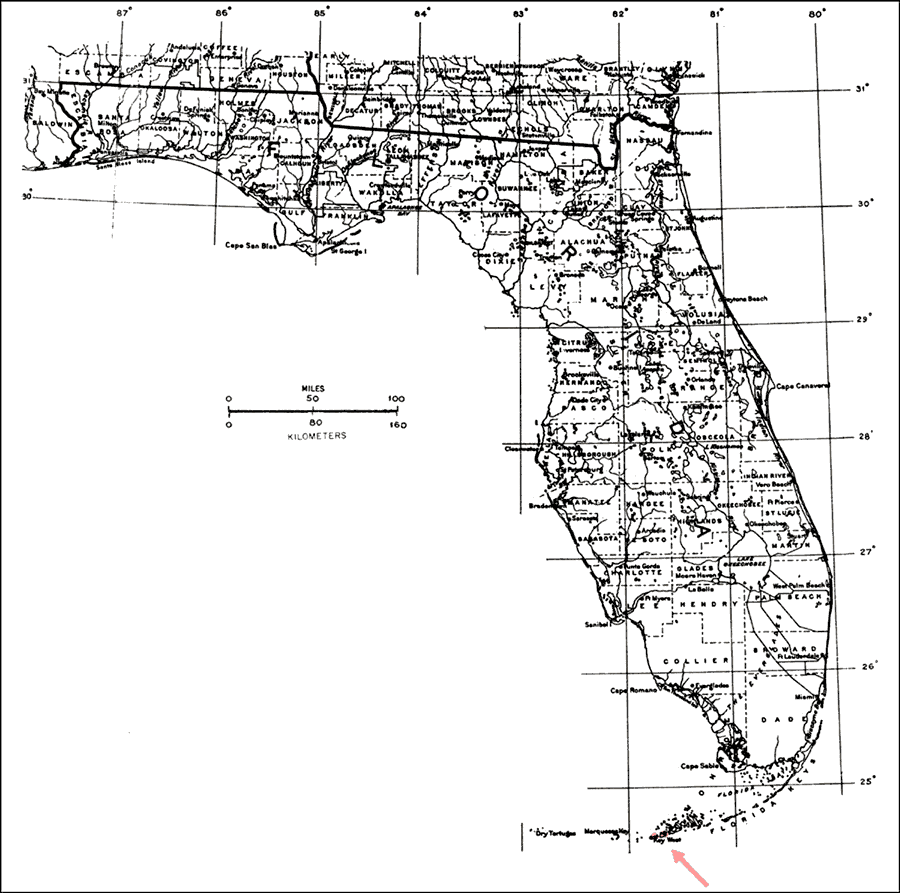
Description: This is a map showing the distribution of the Bourreria radula or rough strongbark in Florida. "Rare at Key West and adjacent Lower Florida Keys, not on s. Florida mainland. Also e. to Hispaniola." —Elbert L. Little, Jr. For more information, read the introduction to the Atlas of United States Trees Vol. 5 Florida.
Place Names: Tropical Hardwoods A-C, natural distribution of native tree species
ISO Topic Categories: biota, boundaries, environment
Keywords: Bourreria radula or rough strongbark, physical, political, forestry, trees, county borders, biota, boundaries, environment, Unknown,1978
Source: Elbert L. Little, Jr., Atlas of United States Trees Volume 5 Florida (Washington, D.C.: United States Government Printing Office, 1978)
Map Credit: United States Government Printing Office |
|