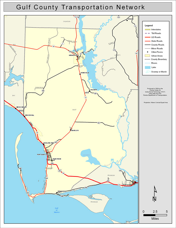
Description: This is a color road map of Gulf county, 2009. It shows the location of many roads including US-98, cities and towns, and inland water.
Place Names: Gulf, Wewahitchka, �Honeyville, �Dalkeith, �White City, �Beacon Hill, �Mexico Beach, �Ward Ridge, �Highland View, �Port Saint Joe, �Port St. Joe, �Indian Pass, �Apalachicola River, �Lake Wimico, �Jackson River, �Gulf of Mexico
ISO Topic Categories: boundaries, �transportation, �inlandWaters, �oceans
Keywords: Gulf County Road Network- Color, transportation, �political, �physical, �kroads, �kroadscolor, county borders, roads, boundaries, �transportation, �inlandWaters, �oceans, Albers_Conical_Equal,2009
Source: Florida Center for Instructional Technology, Exploring Florida: Social Studies Resources �for Students and Teachers (Tampa, FL: University of South Florida, 2009)
Map Credit: Courtesy of the Florida Center for Instructional Technology, Author: Samer Slaiby |
|