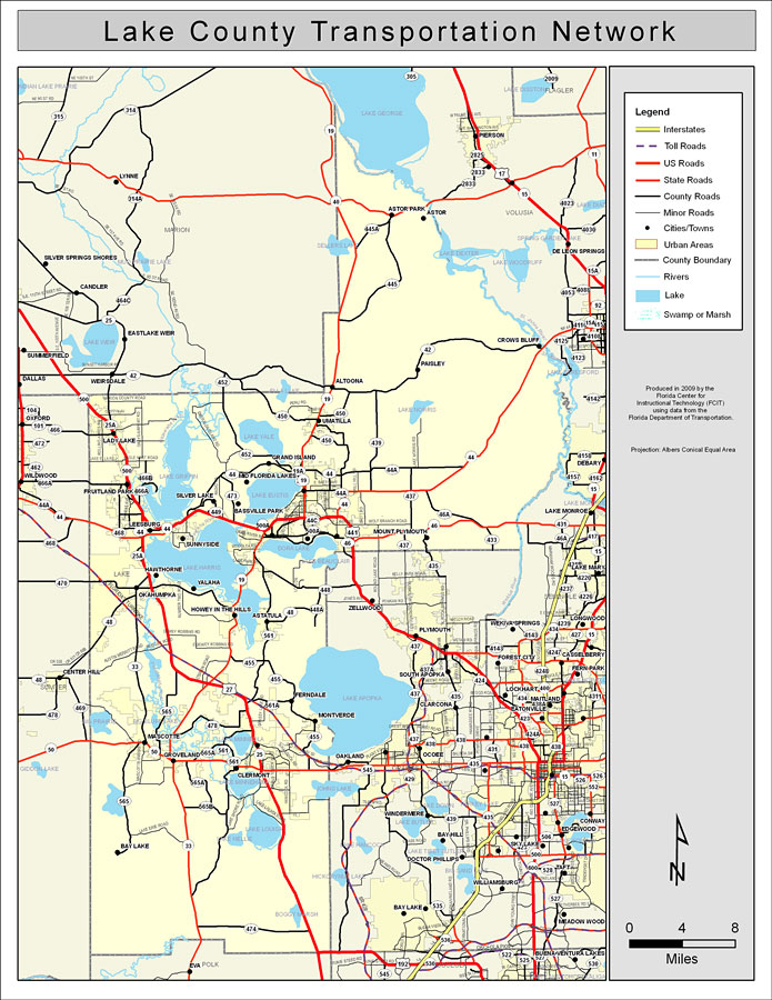
Description: This is a color road map of Lake county, 2009. It shows the location of many roads including US-27, cities and towns, and inland water.
Place Names: Lake, Astor, �Astor Park, �Crows Bluff, �Paisley, �Altoona, �Clermont, �Astatula, �Okahumpka, �Montverde, �Fruitland Park, �Sunnyside, �Zellwood, �Ferndale, �Groveland, �Mascotte, �Bay Lake, �Lake Apopka, �Lake Harris, �Leesburg, �Lake Eustis, �Umatilla, �Eustis
ISO Topic Categories: boundaries, �transportation, �inlandWaters
Keywords: Lake County Road Network- Color, transportation, �political, �physical, �kroads, �kroadscolor, county borders, roads, boundaries, �transportation, �inlandWaters, Albers_Conical_Equal,2009
Source: Florida Center for Instructional Technology, Exploring Florida: Social Studies Resources �for Students and Teachers (Tampa, FL: University of South Florida, 2009)
Map Credit: Courtesy of the Florida Center for Instructional Technology, Author: Samer Slaiby |
|