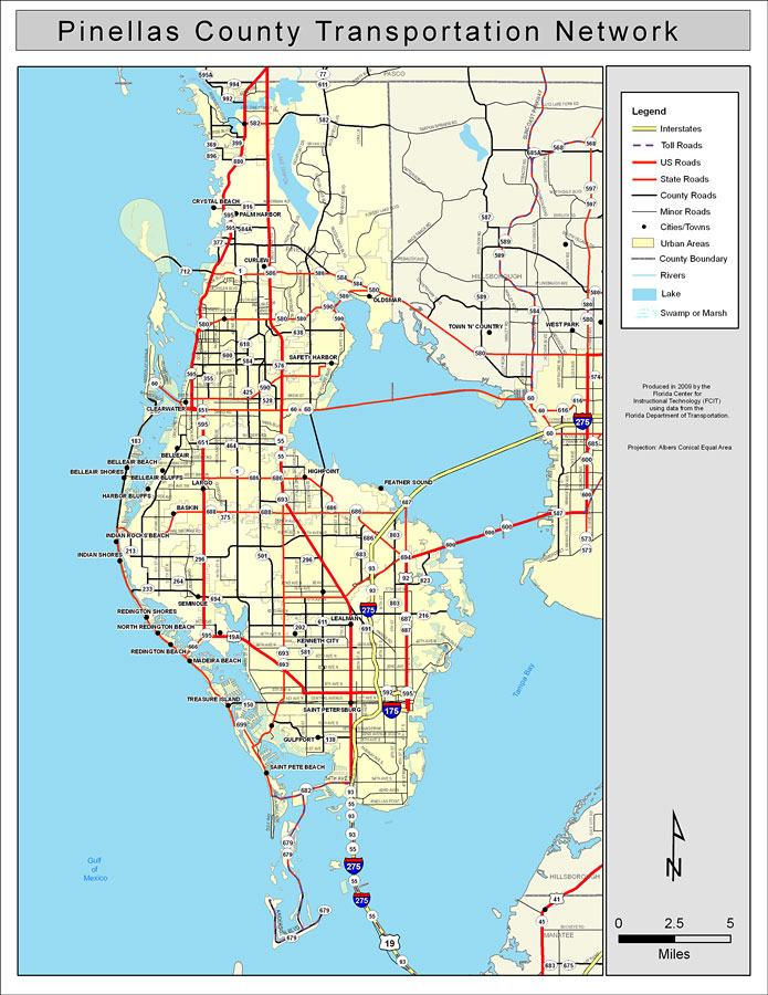
Description: This is a color road map of Pinellas county, 2009. It shows the location of many roads including US-41 and I-75, cities and towns, and inland water.
Place Names: Pinellas, Safety Harbor, �St. Petersburg, �Saint Petersburg, �Saint Pete Beach, �Oldsmar, �Largo, �Indian Rocks Beach, �Belleair, �Clearwater, �Crystal Beach, �North Redington Beach, �Kenneth City, �Baskin, �Seminole, �Feather Sound, �Curlew, �Treasure Island, �Redington Shores, �Madeira Beach, �Harbor Bluffs, �Belleair Beach, �Belleair Shores, �Highpoint, �Tampa Bay, �Gulf of Mexico
ISO Topic Categories: boundaries, �transportation, �inlandWaters, �oceans
Keywords: Pinellas County Road Network- Color, transportation, �political, �physical, �kroads, �kroadscolor, county borders, roads, boundaries, �transportation, �inlandWaters, �oceans, Albers_Conical_Equal,2009
Source: Florida Center for Instructional Technology, Exploring Florida: Social Studies Resources �for Students and Teachers (Tampa, FL: University of South Florida, 2009)
Map Credit: Courtesy of the Florida Center for Instructional Technology, Author: Samer Slaiby |
|