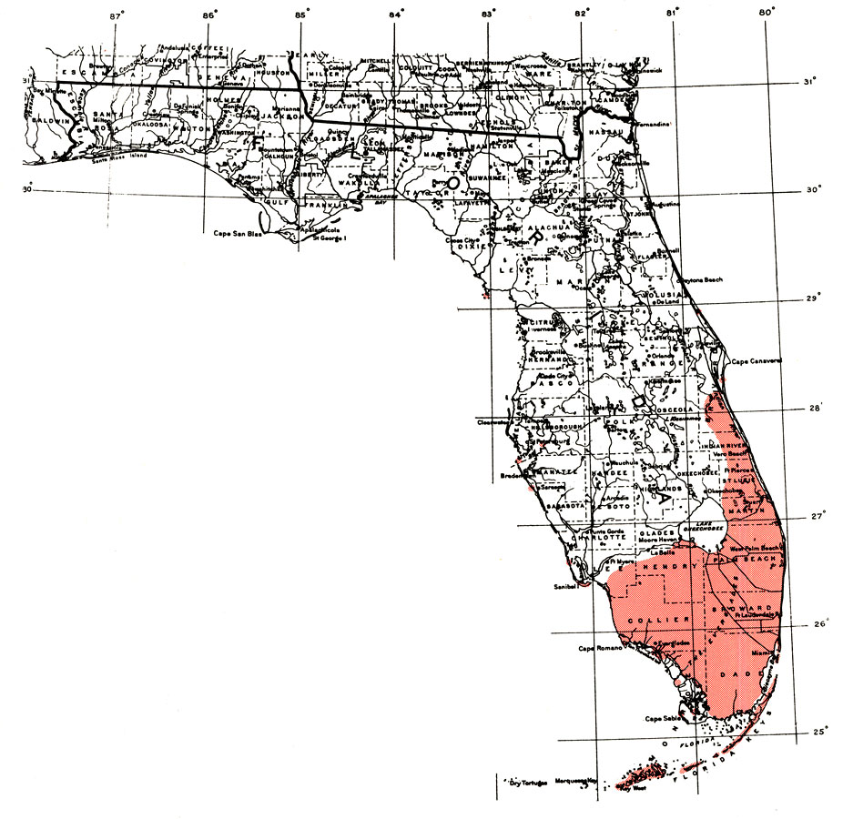
Description: This is a map showing the distribution of the Eugenia axillaris or white stopper in Florida. "C. and s. Florida including Florida Keys. Bermuda and from Bahamas through West Indies including Puerto Rico and Virgin Is. Also var. from se. Mexico and Belize to Nicaragua." —Elbert L. Little, Jr. For more information, read the introduction to the Atlas of United States Trees Vol. 5 Florida.
Place Names: Tropical Hardwoods D-N, natural distribution of native tree species
ISO Topic Categories: biota, boundaries, environment
Keywords: Eugenia axillaris or white stopper, physical, political, forestry, trees, county borders, biota, boundaries, environment, Unknown,1978
Source: Elbert L. Little, Jr., Atlas of United States Trees Volume 5 Florida (Washington, DC: United States Government Printing Office, 1978)
Map Credit: Courtesy the private collection of Roy Winkelman. |
|