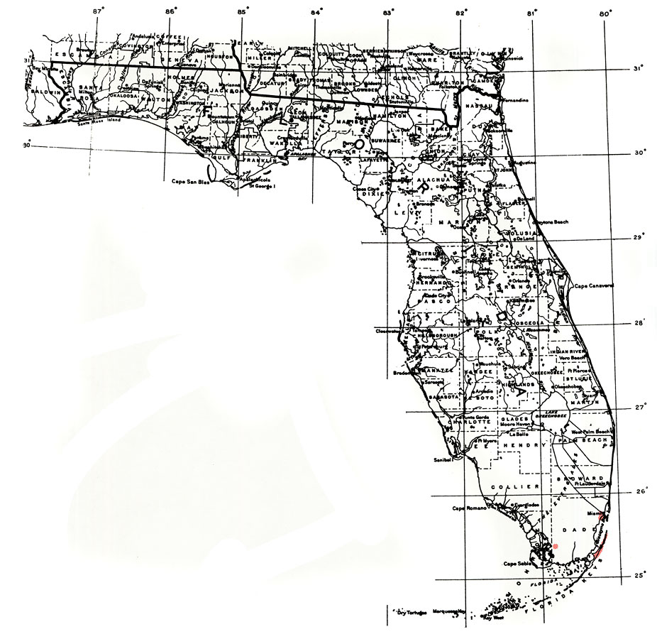
Description: This is a map showing the distribution of the Eugenia confusa or redberry stopper in Florida. "Local in s. Florida (s. Dade Co.) incl. northernmost Upper Fla. Keys, Bahamas, Greater Antilles incl. P.R., Guadeloupe, Dominica, and Trinidad." —Elbert L. Little, Jr. For more information, read the introduction to the Atlas of United States Trees Vol. 5 Florida.
Place Names: Tropical Hardwoods D-N, natural distribution of native tree species
ISO Topic Categories: biota, boundaries, environment
Keywords: Eugenia confusa or redberry stopper, physical, political, forestry, trees, county borders, biota, boundaries, environment, Unknown,1978
Source: Elbert L. Little, Jr., Atlas of United States Trees Volume 5 Florida (Washington, DC: United States Government Printing Office, 1978)
Map Credit: Courtesy the private collection of Roy Winkelman. |
|