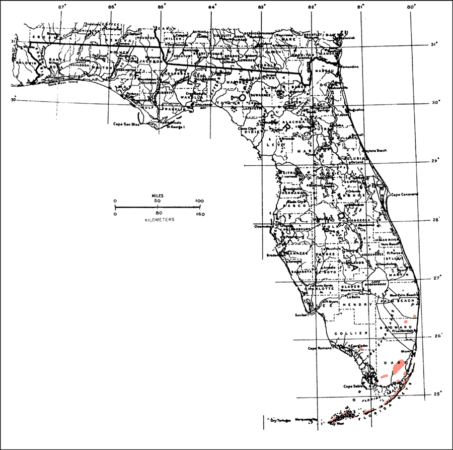
Description: This is a map showing the distribution of the Ficus citrifolia or shortleaf fig in Florida. "S. Florida incl. Florida Keys, n. locally to Palm Beach and Collier Cos. From Bahamas through Greater Antilles incl. P.R. and V.I. Also from Mexico to Guianas (Guyanas) and Paraguay." —Elbert L. Little, Jr. For more information, read the introduction to the Atlas of United States Trees Vol. 5 Florida.
Place Names: Tropical Hardwoods D-N, natural distribution of native tree species
ISO Topic Categories: biota, boundaries, environment
Keywords: Ficus citrifolia or shortleaf fig, physical, political, forestry, trees, county borders, biota, boundaries, environment, Unknown,1978
Source: Elbert L. Little, Jr., Atlas of United States Trees Volume 5 Florida (Washington, D.C.: United States Government Printing Office, 1978)
Map Credit: United States Government Printing Office |
|