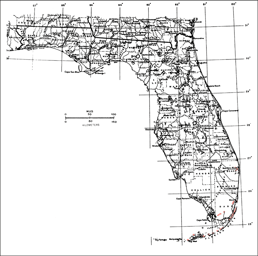
Description: This is a map showing the distribution of the Gymnanthes lucida or oysterwood in Florida. "S. Florida including Florida Keys, local in Dade Co. (extinct in Palm Beach Co.). Bahamas, Grand Cayman, Greater Antilles incl. P.R. and V.I., and n. Lesser Antilles to Guadeloupe. Also se. Mexico, Belize, and Guatemala." —Elbert L. Little, Jr. For more information, read the introduction to the Atlas of United States Trees Vol. 5 Florida.
Place Names: Tropical Hardwoods D-N, natural distribution of native tree species
ISO Topic Categories: biota, boundaries, environment
Keywords: Gymnanthes lucida or oysterwood, physical, political, forestry, trees, county borders, biota, boundaries, environment, Unknown,1978
Source: Elbert L. Little, Jr., Atlas of United States Trees Volume 5 Florida (Washington, D.C.: United States Government Printing Office, 1978)
Map Credit: United States Government Printing Office |
|