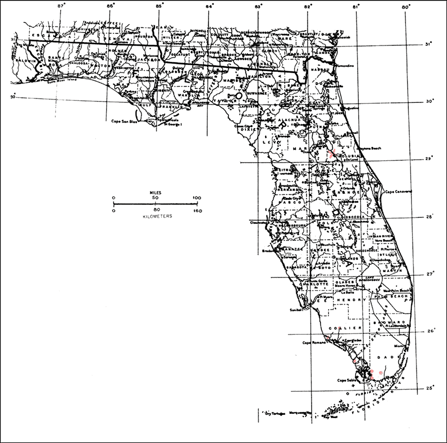
Description: This is a map showing the distribution of the Roystonea elata or Florida royalpalm in Florida. "Rare and local in s. Florida (Dade, Monroe, and Collier Cos. but not on Fla. Keys). Formerly n. to St. Johns River in c. Florida but extinct northward except in cultivation. Also Cuba. Introduced other tropical regions incl. Hawaii, in P.R. and V.I." —Elbert L. Little, Jr. For more information, read the introduction to the Atlas of United States Trees Vol. 5 Florida.
Place Names: Tropical Hardwoods O-Z, natural distribution of native tree species
ISO Topic Categories: biota, boundaries, environment
Keywords: Roystonea elata or Florida royalpalm, physical, political, forestry, trees, county borders, biota, boundaries, environment, Unknown,1978
Source: Elbert L. Little, Jr., Atlas of United States Trees Volume 5 Florida (Washington, D.C.: United States Government Printing Office, 1978)
Map Credit: United States Government Printing Office |
|