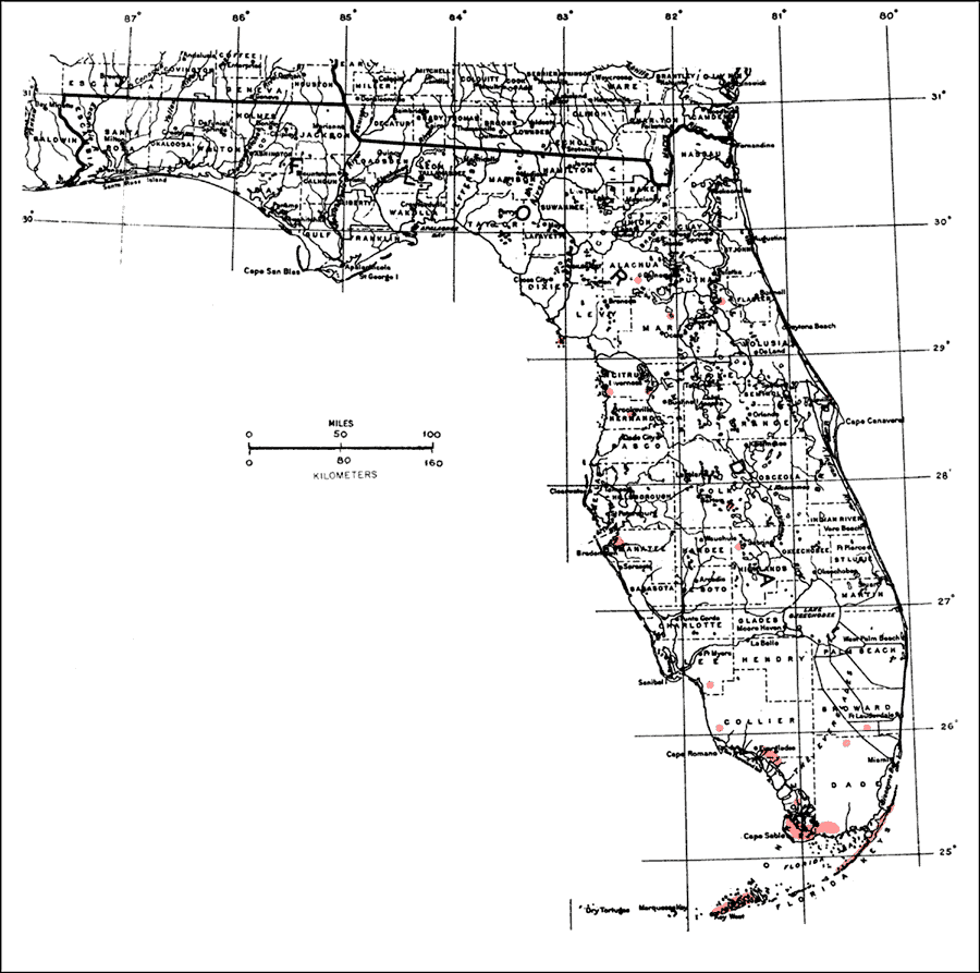
Description: This is a map showing the distribution of the Sapindus saponaria or wingleaf soapberry in Florida. "S. Florida including Florida Keys, n. mainly along coasts to Broward, Collier and Lee Cos., scattered and local n. to n. Florida. Also 2 coastal localities in e. Georgia. Range extended n. by cultivation, partly by prehistoric Indians. Widespread in tropical America. From Bahamas through West Indies incl. P.R. and V.I. Also from n. Mexico s. to Brazil, Paraguay, Argentina, Peru and Ecuador incl. Galapagos Is. Native also in Hawaii and other Pacific islands. Range extended into Old World tropics by cultivation." —Elbert L. Little, Jr. For more information, read the introduction to the Atlas of United States Trees Vol. 5 Florida.
Place Names: Tropical Hardwoods O-Z, natural distribution of native tree species
ISO Topic Categories: biota, boundaries, environment
Keywords: Sapindus saponaria or wingleaf soapberry, physical, political, forestry, trees, county borders, biota, boundaries, environment, Unknown,1978
Source: Elbert L. Little, Jr., Atlas of United States Trees Volume 5 Florida (Washington, D.C.: United States Government Printing Office, 1978)
Map Credit: United States Government Printing Office |
|