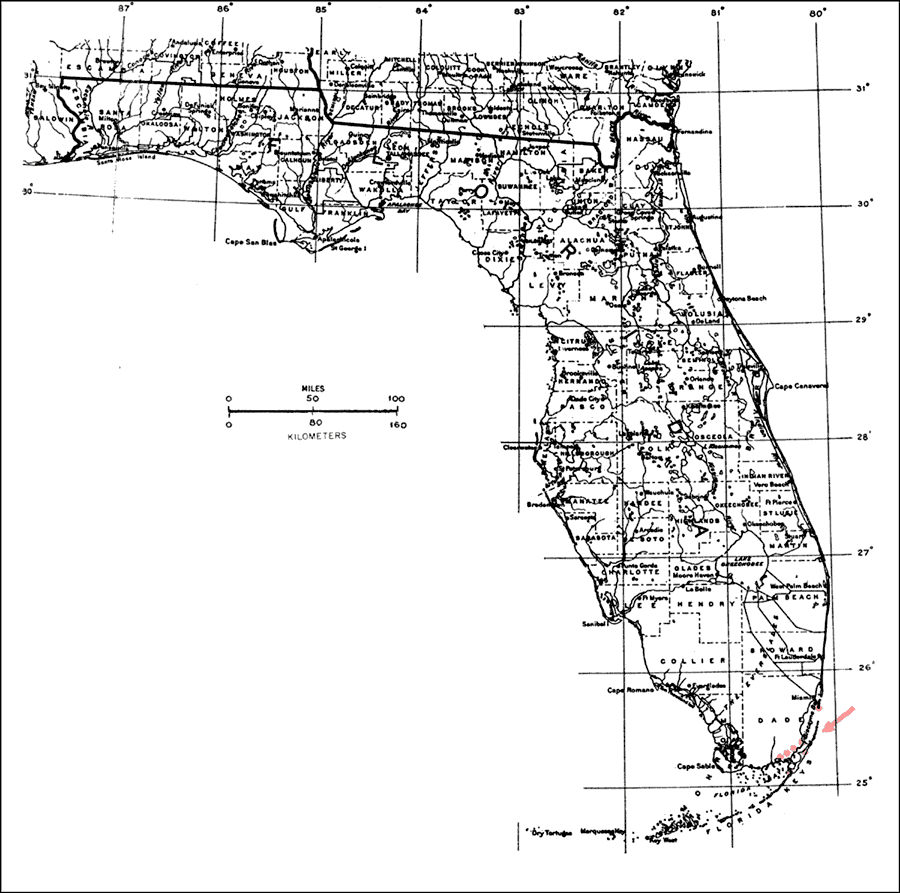
Description: This is a map showing the distribution of the Trema lamarckiana or West Indies trema in Florida. "Local in Upper Florida Keys (Key Largo to Key Biscayne) and adjacent s. Florida mainland (se. Dade Co.). Bermuda and from Bahamas through West Indies incl. P.R. to St. Vincent." —Elbert L. Little, Jr. For more information, read the introduction to the Atlas of United States Trees Vol. 5 Florida.
Place Names: Tropical Hardwoods O-Z, natural distribution of native tree species
ISO Topic Categories: biota, boundaries, environment
Keywords: Trema lamarckiana or West Indies trema, physical, political, forestry, trees, county borders, biota, boundaries, environment, Unknown,1978
Source: Elbert L. Little, Jr., Atlas of United States Trees Volume 5 Florida (Washington, D.C.: United States Government Printing Office, 1978)
Map Credit: United States Government Printing Office |
|