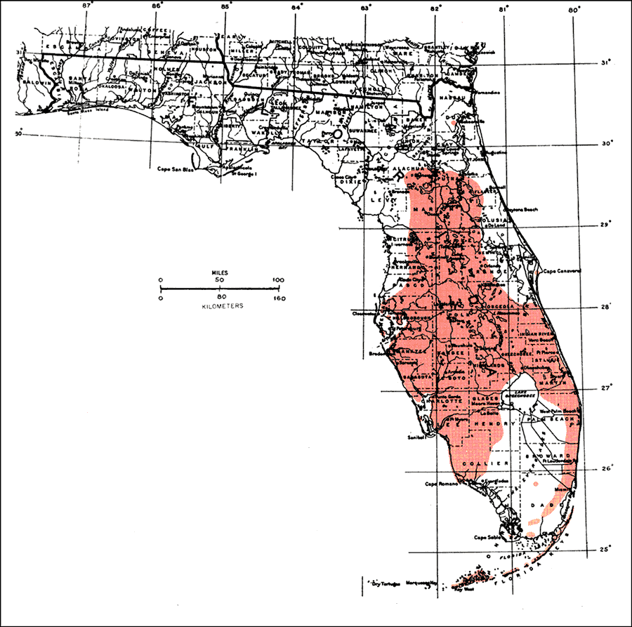
Description: This is a map showing the distribution of the Ximenia americana or tallowwoood in Florida. "N. to s. Florida incl. Florida Keys, mostly near shores. Widely distributed on shores of tropical and subtropical regions and inland in both New and Old Worlds. From Bahamas through West Indies incl. P.R. and St. Thomas. Also from c. Mexico s. to Brazil, Argentina, and Bolivia. Africa, Asia, Australia, and islands of Pacific Ocean." —Elbert L. Little, Jr. For more information, read the introduction to the Atlas of United States Trees Vol. 5 Florida.
Place Names: Tropical Hardwoods O-Z, natural distribution of native tree species
ISO Topic Categories: biota, boundaries, environment
Keywords: Ximenia americana or tallowwoood, physical, political, forestry, trees, county borders, biota, boundaries, environment, Unknown,1978
Source: Elbert L. Little, Jr., Atlas of United States Trees Volume 5 Florida (Washington, D.C.: United States Government Printing Office, 1978)
Map Credit: United States Government Printing Office |
|