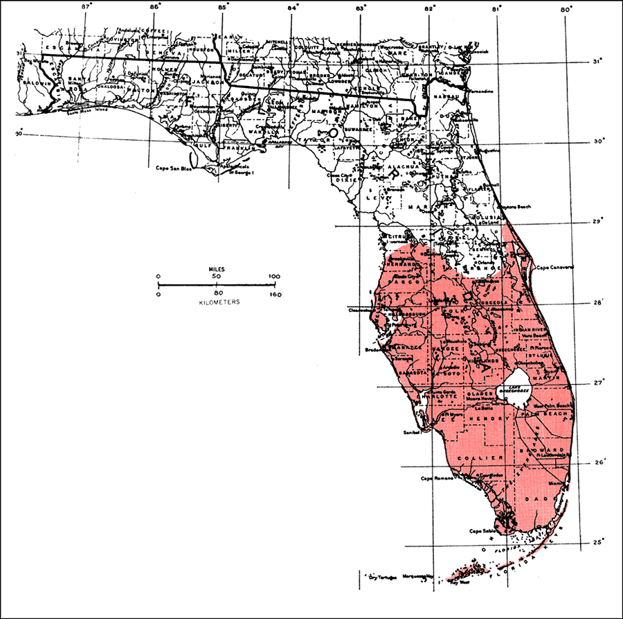
Description: This is a map showing the distribution of the Zanthoxylum fagara or lime prickly-ash in Florida. "C. and s. Florida incl. Florida Keys (n. to Volusia and Citrus Cos.) and se., s., and sw. Texas (n. near coast to Jackson and Matagorda Cos.). Also West Indies in Bahamas, Cuba, Jamaica, Hispaniola, Martinique, and Trinidad. From n. Mexico to Ecuador incl. Galapagos Is. and Peru." —Elbert L. Little, Jr. For more information, read the introduction to the Atlas of United States Trees Vol. 5 Florida.
Place Names: Tropical Hardwoods O-Z, natural distribution of native tree species
ISO Topic Categories: biota, boundaries, environment
Keywords: Zanthoxylum fagara or lime prickly-ash, physical, political, forestry, trees, county borders, biota, boundaries, environment, Unknown,1978
Source: Elbert L. Little, Jr., Atlas of United States Trees Volume 5 Florida (Washington, D.C.: United States Government Printing Office, 1978)
Map Credit: United States Government Printing Office |
|