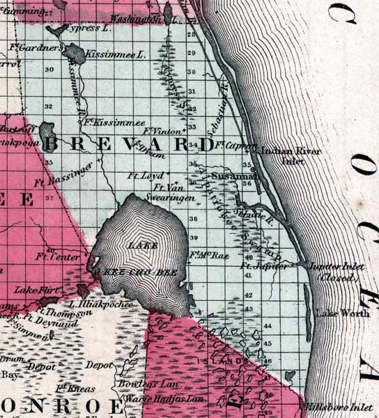
Description: Map of Brevard county, current to 1860, shows county lines, lakes, numerous forts (tagged in the other category), shows Cypress, Kissimmee, Worth, and Okeechobee Lakes. Also shows Cypress and Alapatiokee Swamps, along with Kissimmee, St. Luke, and Sebastian Rivers. Indian Road included.
Place Names: Brevard, Susannal, Ft. Gardner, Ft. Kissimmee, Ft. Vinton, Ft. Swearington, Ft. McRae, Ft. Jupiter, Ft. Drum
ISO Topic Categories: boundaries, inlandWaters, transportation
Keywords: Brevard County, physical, political, historical, transportation, physical features, county borders, roads, boundaries, inlandWaters, transportation, Unknown,1860
Source: Johnson, A.J., Johnson's New Illustrated Family Atlas (New York, NY: Johnson and Browning , 1860) 40
Map Credit: Courtesy the private collection of Roy Winkelman. |
|