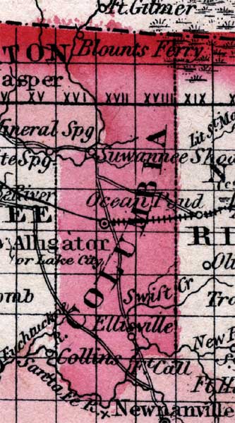
Description: Map of Columbia County, shows Suwannee Shoals, Alligator/Lake City, Ellisville, swift Creek, and several roads.
Place Names: Columbia, Ellisville, Alligator, Suwannee Shoals, Blount's Ferry, Lake City
ISO Topic Categories: boundaries
Keywords: Columbia County, physical, political, historical, physical features, county borders, railroads, boundaries, Unknown,1860
Source: Johnson, A.J., Johnson's New Illustrated Family Atlas (New York, New York: Johnson and Browning, 1860) 40
Map Credit: Courtesy the private collection of Roy Winkelman. |
|