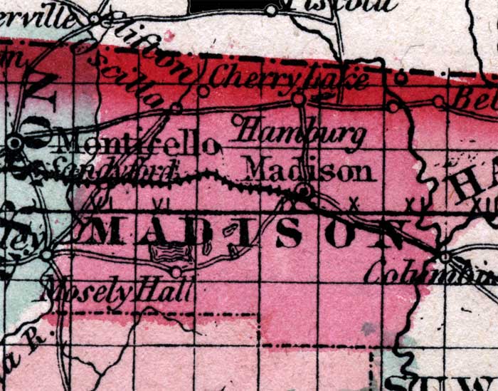
Description: This is a map of Madison County showing the county seat at Madison, other towns and villages, inland waters such as the Suwannee River, railroads, and common roads.
Place Names: Madison, Madison, Moseley Hall, Hamburg, Cherry Lake, Clifton, Oscilla, Suwannee River
ISO Topic Categories: boundaries, inlandWaters, transportation
Keywords: Madison, physical, political, historical, transportation, physical features, county borders, railroads, roads, boundaries, inlandWaters, transportation, Unknown,1860
Source: Johnson, A.J., Johnson's New Illustrated Family Atlas (New York, NY: Johnson and Browning, 1860) 40
Map Credit: Courtesy the private collection of Roy Winkelman. |
|