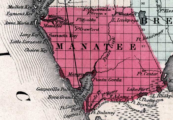
Description: This is a map of Levy County showing towns and villages such as Manatee, forts such as Ft. Hamer, inland waters such as the Manatee River, and railroads.
Place Names: Manatee, Fort Hamer, Ft. Hamer, Anna Maria, Ft. Chiconicla, Ft. Crawford, Ft. Myakka, Punta Gorda, Ft. Center, Ft. Myers, Lake Flirt, Swords Pt., Mangrove Pt., Charlotte Harbor, Gasparilla Pass, Captiva Island, Sarasota Bay, Manatee, Manatee River, Caloosahatchee River
ISO Topic Categories: boundaries, inlandWaters, transportation
Keywords: Manatee, physical, political, historical, transportation, physical features, county borders, railroads, boundaries, inlandWaters, transportation, Unknown,1860
Source: Johnson, A.J., Johnson's New Illustrated Family Atlas (New York, NY: Johnson and Browning, 1860) 40
Map Credit: Courtesy the private collection of Roy Winkelman. |
|