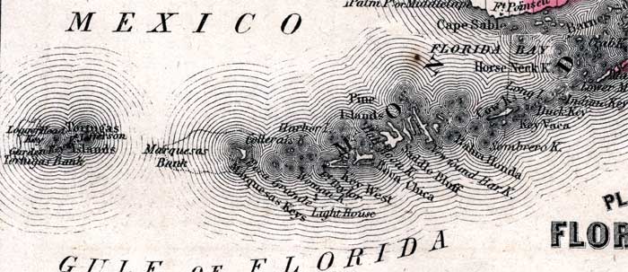
Description: This is a map of the Florida Keys. It shows keys and islands such as Key West, towns or villages such as Cape Sable, oceans such as the Gulf of Mexico, and inland waters such as White Water Bay.
Place Names: Monroe, Key West, Ft. Taylor, Pine Islands, Boca Grande, Marquesas Keys, Key Vaca, Bahia Honda, Saddle Bluff, Boca Chica, Florida Bay, Gulf of Mexico, Gulf of Florida, Cape Sable, White Water Bay
ISO Topic Categories: boundaries, inlandWaters, oceans
Keywords: Plan of the Florida Keys, physical, political, historical, physical features, county borders, boundaries, inlandWaters, oceans, Unknown,1860
Source: Johnson, A.J., Johnson's New Illustrated Family Atlas (New York, NY: Johnson and Browning, 1860) 40
Map Credit: Courtesy the private collection of Roy Winkelman. |
|