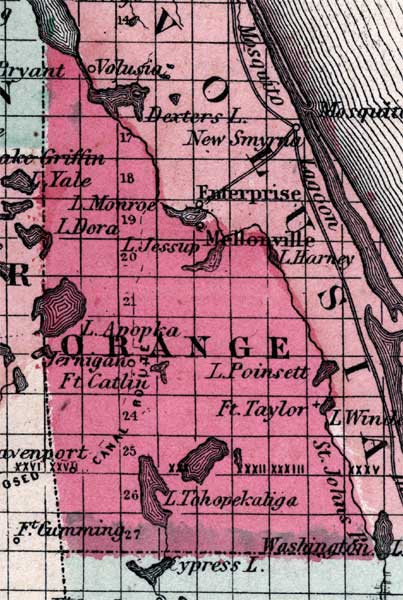
Description: This is a map of Orange County showing the towns and villages such as Mellonville, forts such as Ft. Taylor, and inland waters such as the St. Johns River and Lake Apopka.
Place Names: Orange, Lake Apopka, Jernigan, Ft. Catlin, Ft. Taylor, Lake Tohopekaliga, St. Johns River, Mellonville, Lake Jessup
ISO Topic Categories: boundaries, inlandWaters
Keywords: Orange, physical, political, historical, physical features, county borders, boundaries, inlandWaters, Unknown,1860
Source: Johnson, A.J., Johnson's New Illustrated Family Atlas (New York, NY: Johnson and Browning, 1860) 40
Map Credit: Courtesy the private collection of Roy Winkelman. |
|