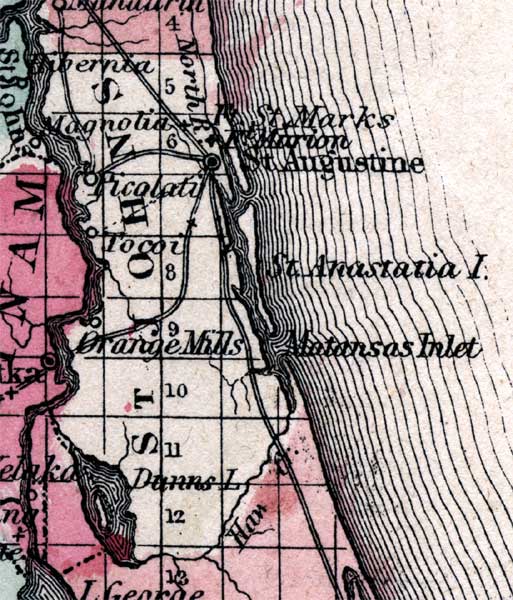
Description: This is a map of St. Johns County showing the county seat at St. Augustine, other towns and villages, forts such as Ft. Marion also known as Castillo de San Marcos, inland waters such as the St. Johns River, and common roads.
Place Names: St. Johns, St. Augustine, Fort Marion, Ft. Marion, Fort San Marcos, Castillo de San Marcos, Ft. St. Marks, St. Johns River, Orange Mills, Anastasia Island, St. Anastasia Island, Danns Lake, Atlantic Ocean, Tocoi, Picolati, Piccolata, Picolata, North River, Matanzas Inlet
ISO Topic Categories: boundaries, inlandWaters, oceans, transportation
Keywords: St. Johns, physical, political, historical, transportation, physical features, county borders, roads, boundaries, inlandWaters, oceans, transportation, Unknown,1860
Source: Johnson, A.J., Johnson's New Illustrated Family Atlas (New York, NY: Johnson and Browning, 1860) 40
Map Credit: Courtesy the private collection of Roy Winkelman. |
|