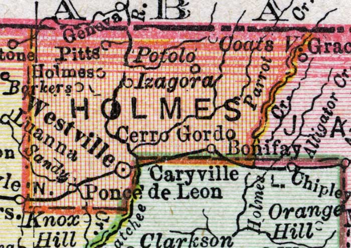
Description: A map of Holmes County showing county lines, the county seat (Westville), railroads, and cities current to 1900.
Place Names: Holmes, Westville, Cerro Gordo, Potolo, Ponce De Leon, Izagora
ISO Topic Categories: transportation, inlandWaters, boundaries
Keywords: Holmes County, physical, political, transportation, physical features, county borders, railroads, transportation, inlandWaters, boundaries, Unknown,1900
Source: , Philadelphia Public Ledger's Unrivaled Atlas of the World (, : , 1900)
Map Credit: Courtesy the private collection of Roy Winkelman. |
|