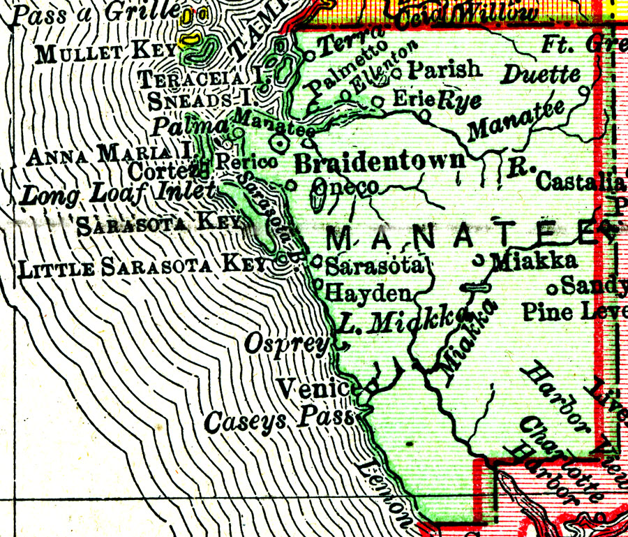
Description: A map of Manatee County showing county lines, the county seat (Braidentown), and cities current to 1900.
Place Names: Manatee, Bradenton, Sarasota, Rye, Ellenton, Erie, Parish, Palmetto, Myakka City, Anna Maria, Cortez
ISO Topic Categories: inlandWaters, boundaries, oceans
Keywords: Manatee County, physical, political, physical features, county borders, inlandWaters, boundaries, oceans, Unknown,1900
Source: , Philadelphia Public Ledger's Unrivaled Atlas of the World (, : , 1900)
Map Credit: Courtesy the private collection of Roy Winkelman. |
|