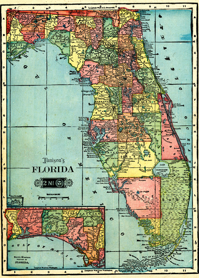
Description: This map of Florida shows county boundaries, wetlands, and railroads connecting major cities current to 1904. There is an inset map of the Northwest portion (panhandle) of the state.
Place Names: 1900-1919, Key West, Orlando, Tampa, Cape Canaveral, Saint Augustine, Pensacola, Fort Myers, Fort Lauderdale, Daytona Beach, Gainesville, Jacksonville, Miami, Sarasota, Tallahassee, St Petersburg, West Palm Beach, Naples
ISO Topic Categories: boundaries, transportation, inlandWaters, oceans
Keywords: Florida, physical, political, transportation, swamps, everglades, wetlands, physical features, county borders, railroads, boundaries, transportation, inlandWaters, oceans, Unknown,1904
Source: , Tunison's Florida (, : , 1904)
Map Credit: Courtesy the private collection of Roy Winkelman. |
|