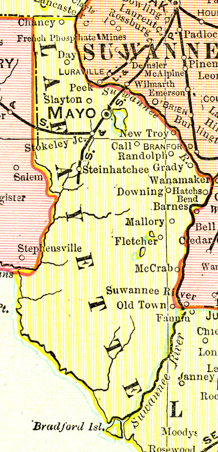
Description: A map of Lafayette County showing county lines, the county seat (Mayo), and railroads connecting the major cities current to 1899.
Place Names: Lafayette, Chancey, Day, Mayo, Steinhatchee, Randolph, Grady, Hatchbend, Mallory Swamp, Downing
ISO Topic Categories: boundaries, inlandWaters, oceans, transportation
Keywords: Lafayette County, physical, political, transportation, physical features, county borders, railroads, boundaries, inlandWaters, oceans, transportation, Unknown,1899
Source: George F. Cram, (Chicago, IL: George F. Cram Company, 1899) 174-175
Map Credit: Courtesy the private collection of Roy Winkelman. |
|