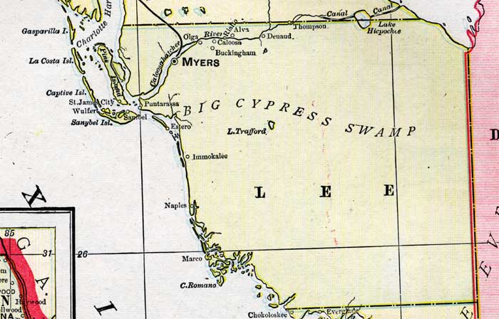
Description: A map of Lee County showing county lines, the county seat (Myers), and railroads connecting the major cities current to 1899.
Place Names: Lee, Thompson, Denaud, Caloosa, Myers, Puntarassa, Wulfert, Sanibel, Estero, Naples, Marco, Cape Romano, Buckingham, Olga, Imokalee, Punta Rassa, Captiva
ISO Topic Categories: boundaries, inlandWaters, oceans, transportation
Keywords: Lee County, physical, political, transportation, physical features, county borders, railroads, boundaries, inlandWaters, oceans, transportation, Unknown,1899
Source: George F. Cram, (Chicago, IL: George F. Cram Company, 1899) 174-175
Map Credit: Courtesy the private collection of Roy Winkelman. |
|