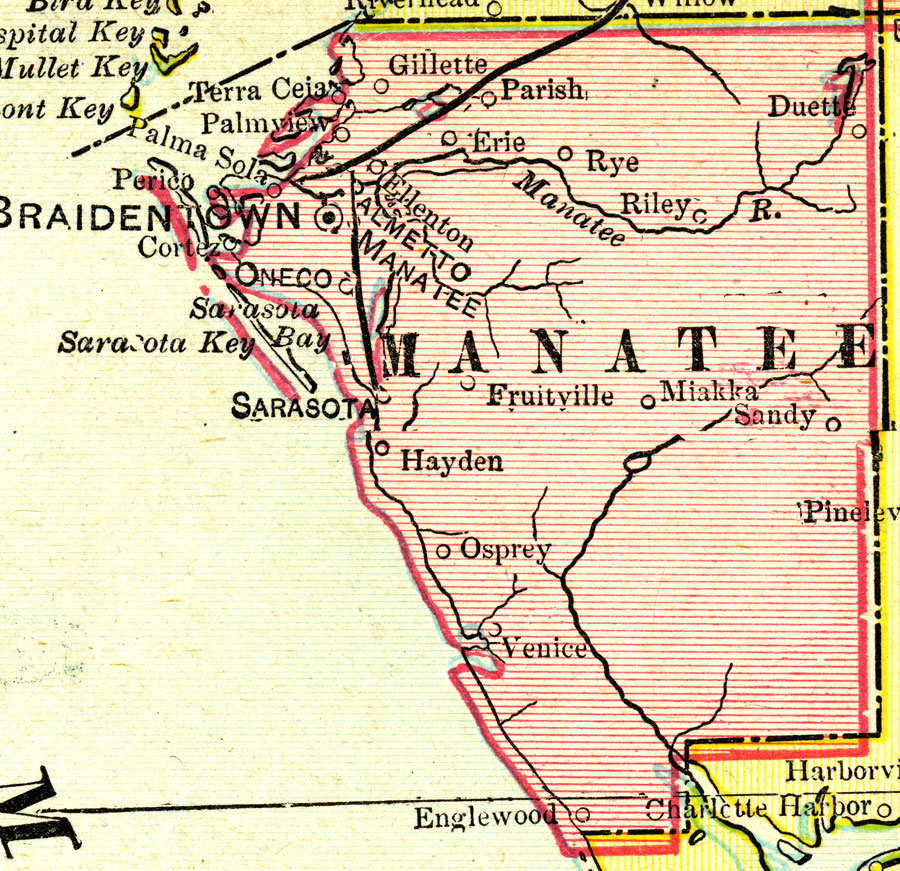
Description: A map of Manatee County showing county lines, the county seat (Braidentown/Bradenton), and railroads connecting the major cities current to 1899.
Place Names: Manatee, Palmetto, Parish, Manatee, Bradenton, Braidentown, Erie, Rye, Sarasota, Miakka, Sandy, Duette, Riley, Gillette
ISO Topic Categories: boundaries, inlandWaters, oceans, transportation
Keywords: Manatee County, physical, political, transportation, physical features, county borders, railroads, boundaries, inlandWaters, oceans, transportation, Unknown,1899
Source: George F. Cram, (Chicago, IL: George F. Cram Company, 1899) 174-175
Map Credit: Courtesy the private collection of Roy Winkelman. |
|