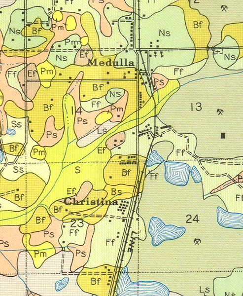
Description: A section of the Soil Map for Polk County produced by the United States Department of Agriculture, Bureau of Chemistry and Soils in conjunction with the Florida State Geological Survey. This map shows roads, railroads, and the major soil groups found around the cities of Medula and Christina, Florida.
Place Names: Polk, Medula, Christina
ISO Topic Categories: geoscientificInformation, transportation
Keywords: Medula and Christina, Florida, physical, transportation, physical features, geological, roads, railroads, geoscientificInformation, transportation, Unknown,1927
Source: W. Edward Hearn, Soil Map: Polk County, Western Sheet (Washington, DC: United States Department of Agriculture, 1927)
Map Credit: Courtesy the private collection of Roy Winkelman |
|