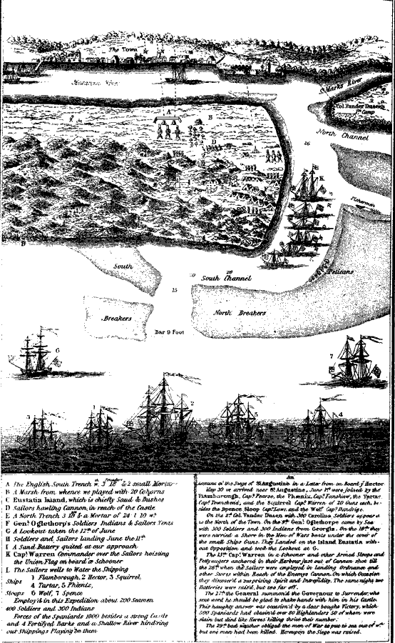
Description: Map shows the historical layout of ships and troops, along with cannon positions, before attacking St. Augustine on June 20, 1740. Shows the water depths in the river around the fort and city.
Place Names: 1740-1759, Saint Augustine
ISO Topic Categories: structure, inlandWaters
Keywords: Town and Castle of St. Augustine, hydrological, historical, physical, physical features, water depths, structure, inlandWaters, Unknown,June 20, 1740
Source: Charles B. Reynolds, Old Saint Augustine (St. Augustine, FL: E. H. Reynolds, 1888) 81
Map Credit: Courtesy the private collection of Roy Winkelman |
|