mapsExploring Florida
 FL Maps > Region > 1760-1779 > St. Augustine the Capital of East Florida, 1775
Site Map 

St. Augustine the Capital of East Florida, 1775

St. Augustine the Capital of East Florida


Title: St. Augustine the Capital of East Florida
Projection: Unknown
Source Bounding Coordinates:
W: E: N: S:

Main Map Page
Zoomify Version
B/W PDF Version
Puzzles: Easy, Medium, Hard
Google Earth
GIS Files
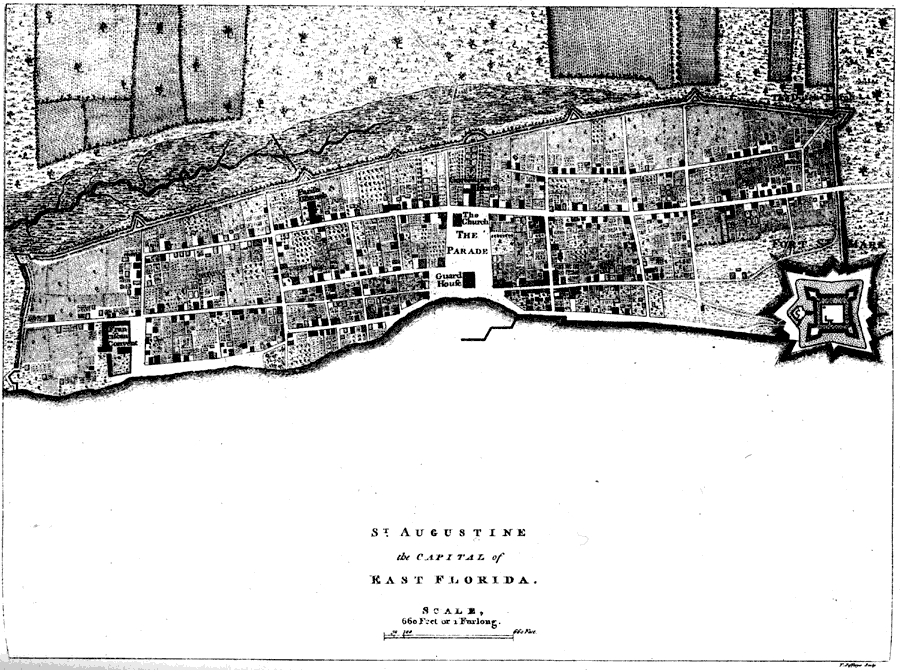
Description: Map shows the layout of St. Augustine and surrounding area during 1775 C.E. Labels the important buildngs in the city , including the fort.
Place Names: 1760-1779, Saint Augustine
ISO Topic Categories: inlandWaters, structure
Keywords: St. Augustine the Capital of East Florida, physical, historical, transportation, physical features, roads, inlandWaters, structure, Unknown,1775
Source: Charles B. Reynolds, Old Saint Augustine (St. Augustine, FL: E. H. Reynolds, 1888) 91
Map Credit: Courtesy the private collection of Roy Winkelman
SearchLicensePDF HelpGIS Help Google Earth Help Zoomify Help

 FL Maps > Region > 1760-1779 > St. Augustine the Capital of East Florida, 1775
Site Map